  • Environmental Services

    icon environment landing

Mobile Data Collection, Mapping and Spatial Analysis

EDM provides state-of-the-art mapping and spatial analysis support with the latest ArcGIS, AutoCAD and CartoPac software and Trimble hardware featuring sub-foot GPS accuracy. A full project cycle might include planning and field study maps, make-ready work drawings, a construction atlas, as-built drawings and an operations and maintenance plan atlas. Where needed, spatial data is collected in the field using custom, project-specific forms based on CartoPac’s GPS/GIS-enabled mobile data collection platform. EDM uses natural resources data to model environmental impacts, compare project alternatives and develop appropriate mitigation measures. Mobile data collection integrated with cloud-based mapping streamlines work flow, improves accuracy and maximizes worker efficiency.

GIS Technical Specialties Include:

  • APP, ARA & Permitting & Compliance Support
  • Mobile Data Collection Hardware, Software, & Integration
  • Cartography & Graphic Design
  • Full Project Cycle Map Development
  • Siting & Routing Comparative Analyses
  • Statistical & Spatial Modeling
  • Cloud-based GIS Integration
  • Scripting & Automation
  • Geodatabase & Workflow Development
  • System & Asset Mapping

FEATURED PROJECT

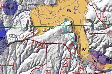
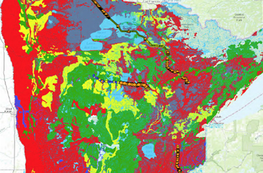
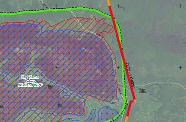
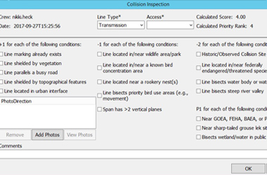
Tasked with delineating priority structures for eagle-friendly electrical retrofits in a 12,000‑square-mile service territory, EDM modeled the region in GIS, using habitat, nesting, and observational data to calculate the relative priority of each 30-meter grid cell. In an iterative process, features in each data layer were assigned positive or negative weights based on the scientific literature and EDM’s deep expertise in avian protection planning. Priority areas were smoothed and aggregated using nearest-neighbor techniques, generating minimum-sized polygons for field personnel and planners. Deliverables included identification of eagle priority areas and an ESRI model, facilitating improvements and updates as new data become available.


GIS Mapping Edm International 01
GIS Mapping Edm International 02
GIS Mapping Edm International 03
GIS Mapping Edm International 04
GIS Mapping Edm International 05
GIS Mapping Edm International 06
GIS Mapping Edm International 07
GIS Mapping Edm International 08
GIS Mapping Edm International 09
GIS Mapping Edm International 10
GIS Mapping Edm International 11
GIS Mapping Edm International 12
GIS Mapping Edm International 13