Uncrewed Aerial Systems (UAS)
EDM’S team of FAA certified UAS pilots specialize in collecting the data needed by electric utilities, at a fraction of the cost of traditional methods. Paired with EDM’s expert utility and GIS teams, we provide end-to-end analysis and reporting to improve electric utility infrastructure.
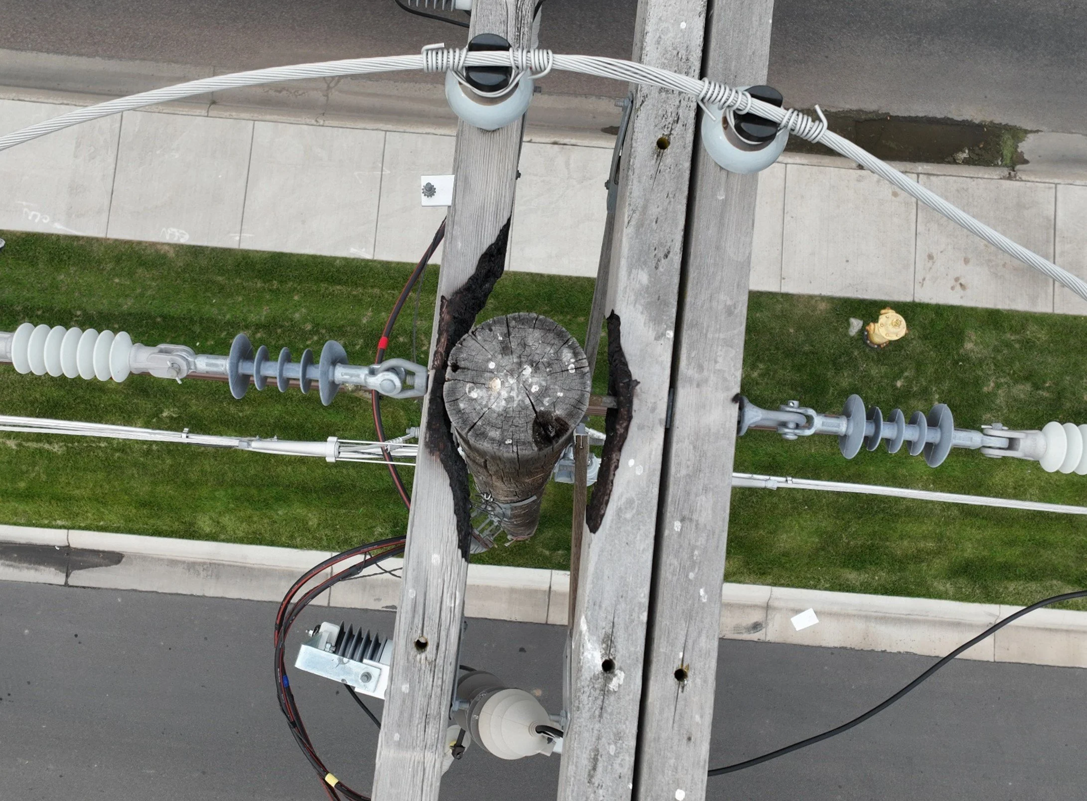
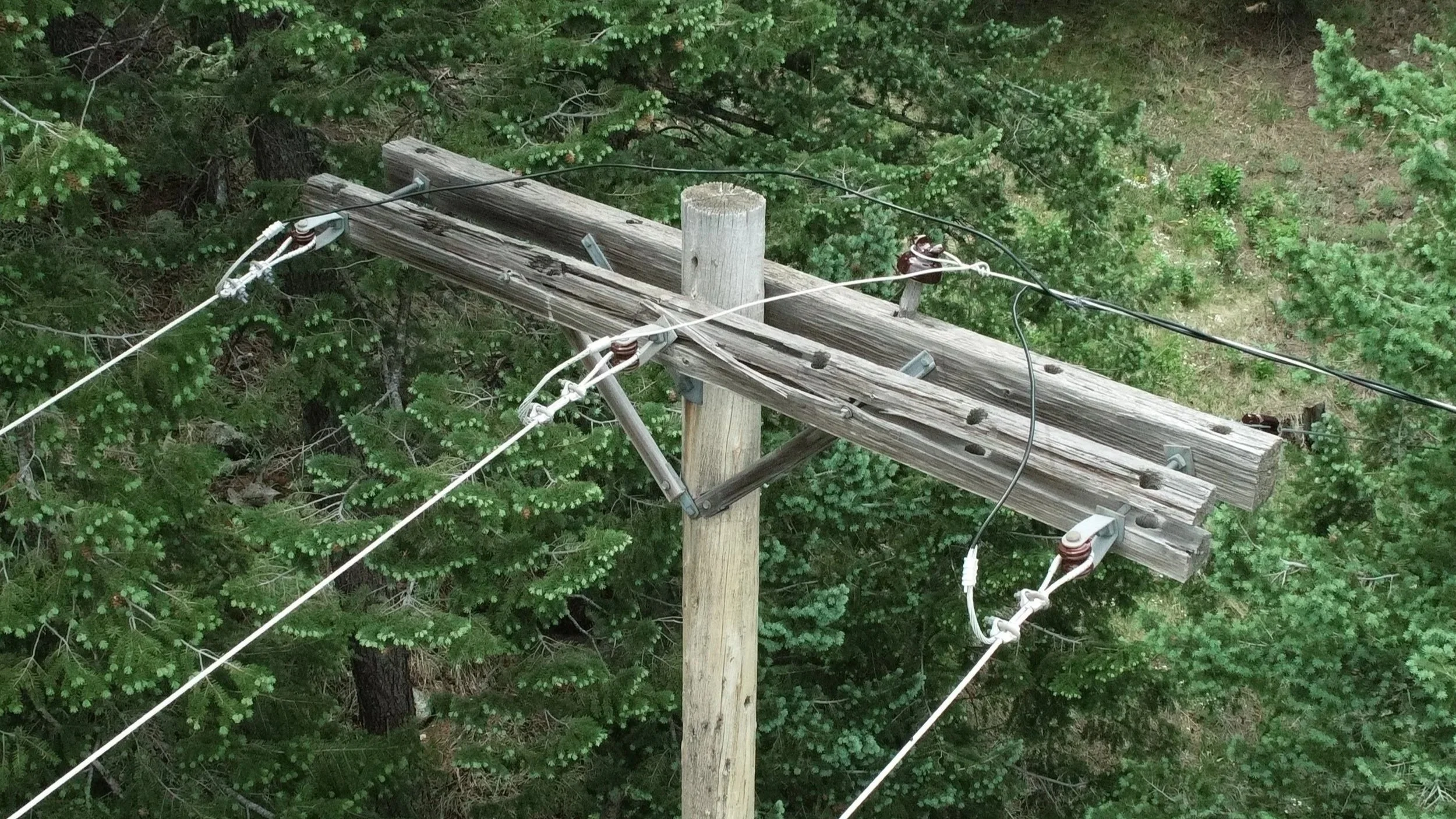
VISUAL & THERMAL INSPECTION
Visual and thermal defect discovery
Wildfire mitigation virtual inspection
Inventory and joint-use imaging and reporting
Structure and conductor condition assessment
Transmission construction QA/QC
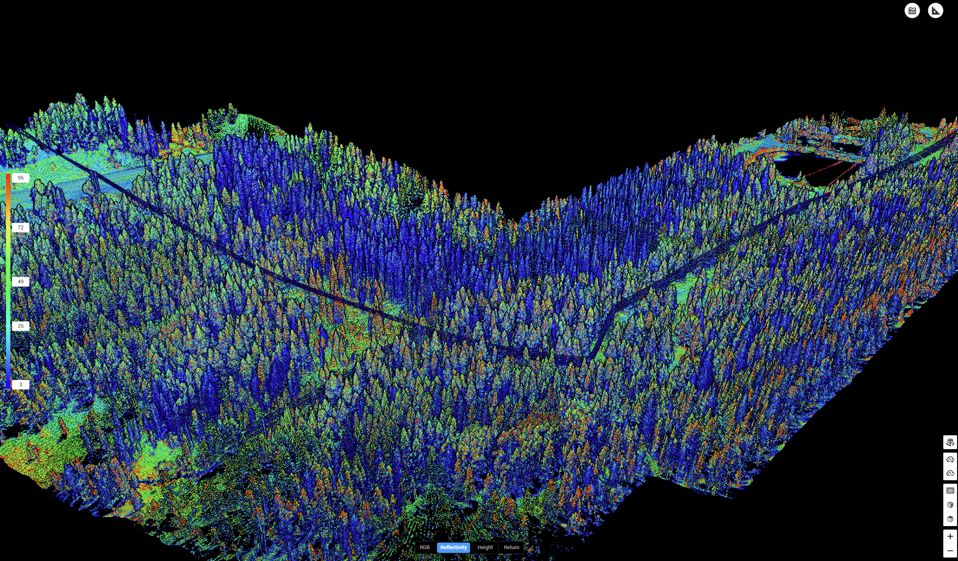
LiDAR MODELING & VEGETATION MAPPING
High-density aerial LiDAR acquisition
Vegetation encroachment clearance modeling
Bare-earth digital terrain models
GIS-integrated point cloud deliverables
WILDFIRE MITIGATION SUPPORT
Wildfire risk zone asset inspection and defect discovery
Vegetation fuel load analysis
Thermal risk identification
ROW wildfire mitigation assessments
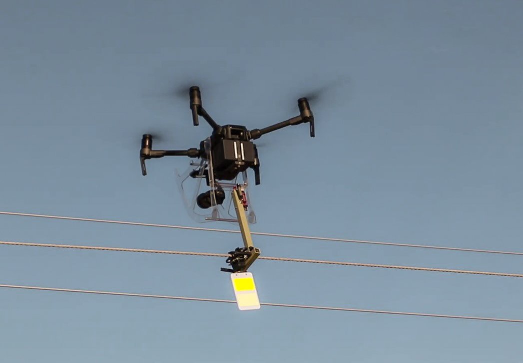
LINE MARKER INSTALLATION
Aerial installation of line markers
Energized transmission line deployment
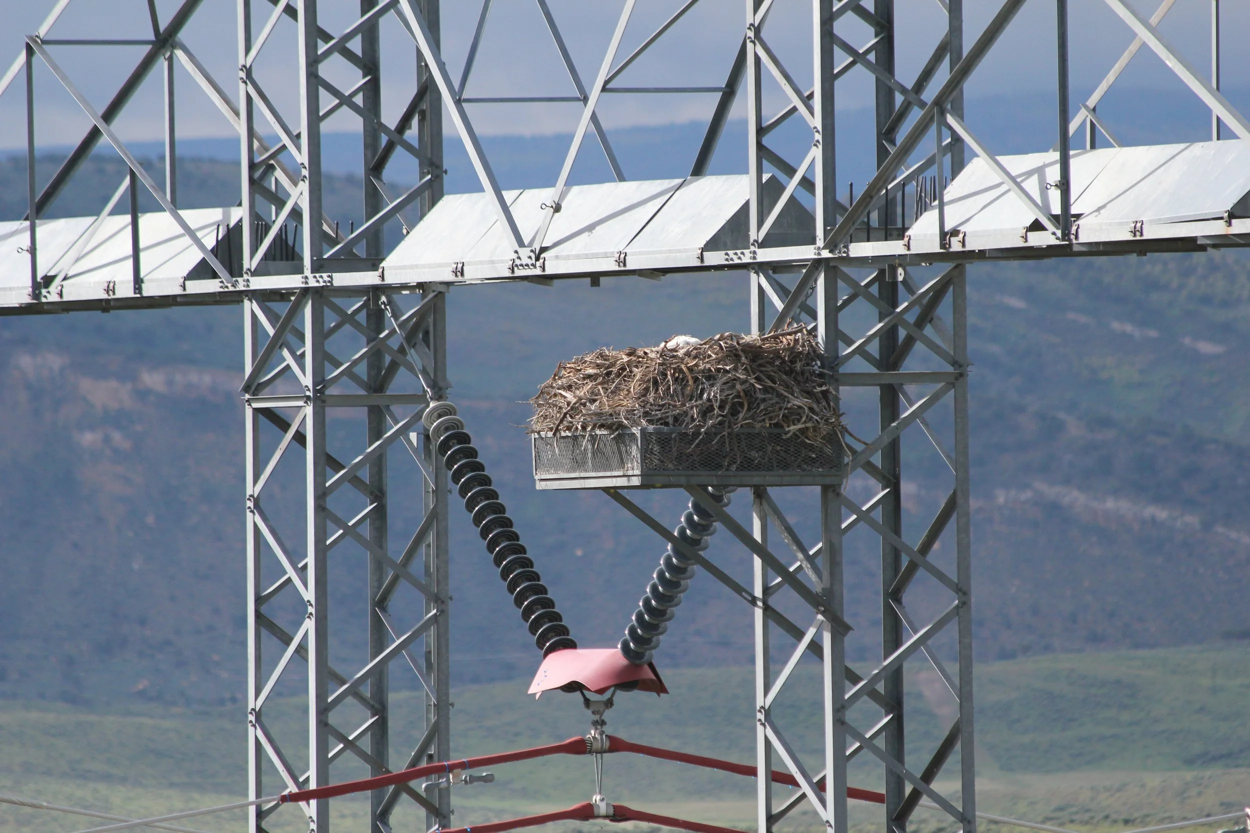
Avian collision mitigation measures
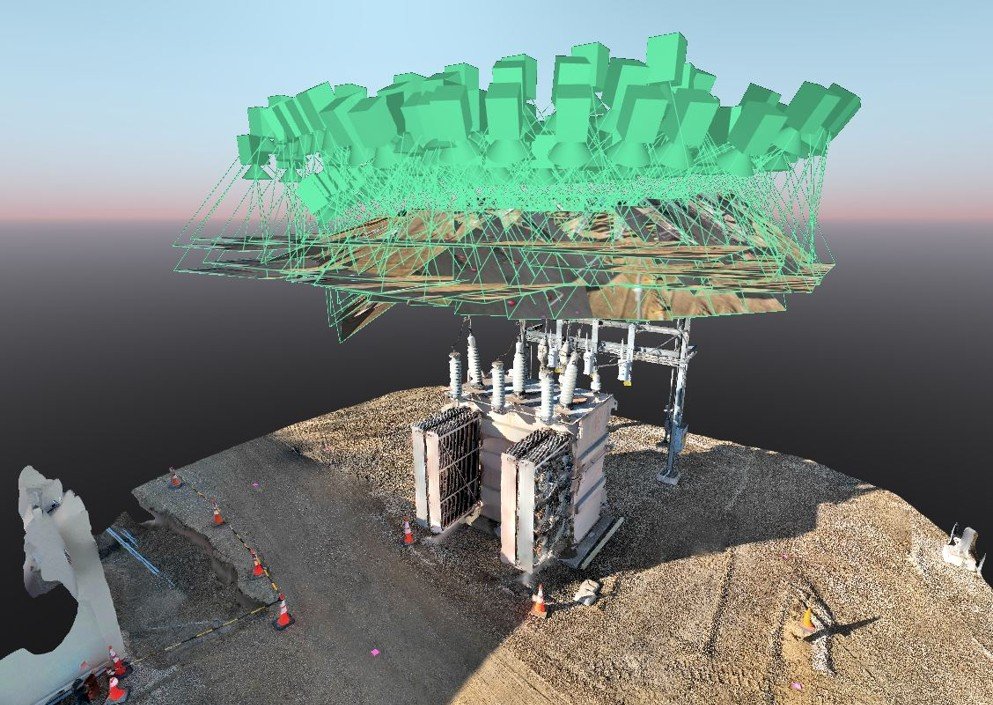
ORTHOMOSAIC MODELING & MAPPING
Georeferenced orthomosaic image products
High-accuracy aerial photogrammetry
Corridor and site mapping
Change detection image analysis
Energized substation measurement
WILDLIFE MONITORING & RESEARCH
Aerial wildlife survey data collection
Species presence and distribution analysis
Habitat condition monitoring
GIS-compatible ecological datasets